 |
|
Stuart's ride to July 1st added. |
This page contains two maps similar to those already seen if you are taking these pages in order, and two pictures which will be seen again. The objective is to set a feel for the distances involved.
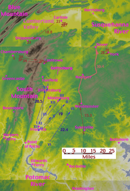
A well trained athlete can cover a 26 mile marathon in well under 3 hours. A well trained Civil War army, with full equipment, but without wagons, takes a full day to cover the same 26 miles. At that, the army will complain loudly about having to do so, leave stragglers behind, and will much later boast of the feat to their grandchildren. It is about two miles between the Round Tops and Cemetery Hill. On the morning of June 29 to 30 march map shown below, the inverted J fish hook is to scale, a two mile distance. The Union VI Corps (20.8 miles as the crow flies), Longstreet's I Corps (25), Rodes and Johnson at Carlisle (26), and Stuart's cavalry at Westminster (21) are all just under 26 miles from Gettysburg. This does not include the inevitable twists and turns in the roads. Stuart's July 30 march has been added in orange. In addition to 45 miles in 2 days, Stuart fought skirmishes at Westminster and Hanover, and would face further action in Carlisle and Gettysburg in the next few days.
|
|
|
Stuart's ride to July 1st added. |
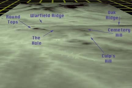
West and slightly south of Gettysburg, just northeast of Fairfield on the above map, there is an unusual pattern of hills shown in green on yellow. The Round Tops, Cemetery and Culp's hills are too small to show clearly on the above strategic map, and overwritten by the pink fish hook of Meade's battle line. The South Mountain foothills at Fairfield are not. Take a hard look at the pattern of hills south of Pender's and Heth's Confederate III Corps divisions, already through the gap. The same hills are shown below. The below map uses the more detailed data sets, and is rendered looking west. North is to the right.
 |
|
|
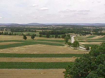
The photo below was taken from the South Tower looking west. South Tower is located roughly where the "Warfield Ridge" arrow is pointing on the above map. The color scheme used for the above maps was designed to emphasize the high ground. It may have succeeded too well. Below is a view of the Fairfield foothills from just above the tree line. South Mountain's central spur is on the horizon. The terrain is gentle and rolling. One could cross any of the local ridges with no need for technical climbing equipment. Still, it was faster for Longstreet to wait for the II and III Corps to finish using the single road through the Cashtown Gap rather than to try to go straight over South Mountain. Also - as is clear in the below photograph - South Mountain is better understood as a ridge than as a mountain.
 |
|
|
 |
|
|
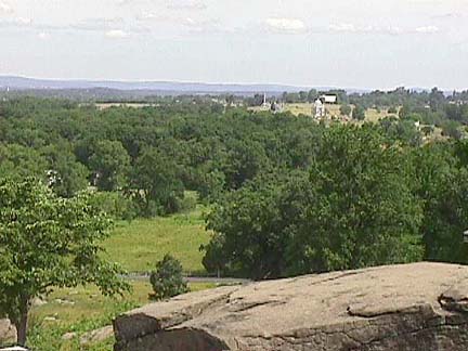
Finally, the right side of the above picture shows Cemetery Ridge, the shank of Meade's fish hook. The white square in the trees just below the horizon is the Cyclorama building, square on top of Cemetery Hill. The distance is a little under two miles. Below, in the foreground is Sickles' Hole. The northeast spur of South Mountain is on the horizon. Compare this against the map at the top of the page.
Next : July 2nd South. A closer look at the southern end of the battle field.